Playing around with making “tours”. You start at one location then look for the directions (small ^ icon) to go to the next location within LeFurge Nature Preserve. If you are seeing a black rectangle with icons on it in the picture, then I am not working to support your device. (Don’t feel bad, it doesn’t work on some of mine either!). To make the pictures show on older hardware I must convert the picture size to a “1×2” format. Even if carefully done this distorts the image, which means other people see a less than optimum image. So. . . Sorry
The icons with the small camera indicate a photo is attached. Click on the icon to see it. The hiker icon takes you to the next view, or preserve.
There is also a small compass rose icon on most views. Depending on the layout I use it can be in different locations. This is set so the solid end of the pointer shows North. Click on the icon to turn the view to face North.
Use the double arrow at the bottom right to go “Full Screen” for the best experience! You can use the “Esc” key to close that window when you are done.
Morris-Reichert
Bell Creek Preserve
16401 Harrison St., Livonia, MI 48154
The old farmhouse is now used as the offices for the Southeast Michigan Land Conservancy.
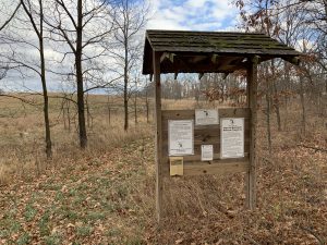
information you may wish to read before heading out on the trail.
The Big Red Barn! Home to a Brown Bat colony.
There is an annual count where volunteers gather on the lawn
to tally the bats as they fly out in the evening.
The old milk cooler is still inside. The milking room is still in the red barn.
The other end of the milk house has a room for mechanical repairs,
and old tack for the livestock.
The old hewn log cabin. I hear tell it slept a family of eight!
Later, it appears to have been a home for chickens.
A small shed with slatted crib inside to dry the corn for later use.
Hiding behind the large silo is the sugar shack.
A metal roof, a tin smoke stack, seems like it would
have been a good place to make maple syrup.
Wide sliding doors on the front allowed easy egress for carriages.
A newer building, now used for storing stewardship equipment.
Come on out and get a plot for growing some tasty organic veggies!
and you will be at the LeFurge Preserve Trailhead.
turn left (West) and head into the woods.
Take the fork to the right (North) and follow the trail!
watch for the Conservancy Farm sign.
No ticket needed!
No TSA full body scan required!
No sea sickness!
No unruly kids, behind you, staring over the seat at you,
or beside you (with grubby hands)!
Maybe not so good for slow connections, or limited data plans!


Not really good parking here. Park at the Conservancy farm, and walk here, it's a nice walk.
Or, if you are coming this way, turn left and you will find the entrance to Meyer Preserve,
turn right, and you will go to the Conservancy Farm.
for the LeFurge Prospect Road trail head,
The meadows, and the SE Fields.
be warned it is often muddy!
Boardwalks are being constructed,
but it takes time, and money.


The hill and ponds are none of them. Just so you know.
Swamp Brush GC12WMY and New 2U3? GCWR8H
Park here for both of them.
There are also a couple "Treasure Chest" geoart caches up on Vreeland.

Look around, enjoy nature.
Sit quiet for awhile and look for wildlife.
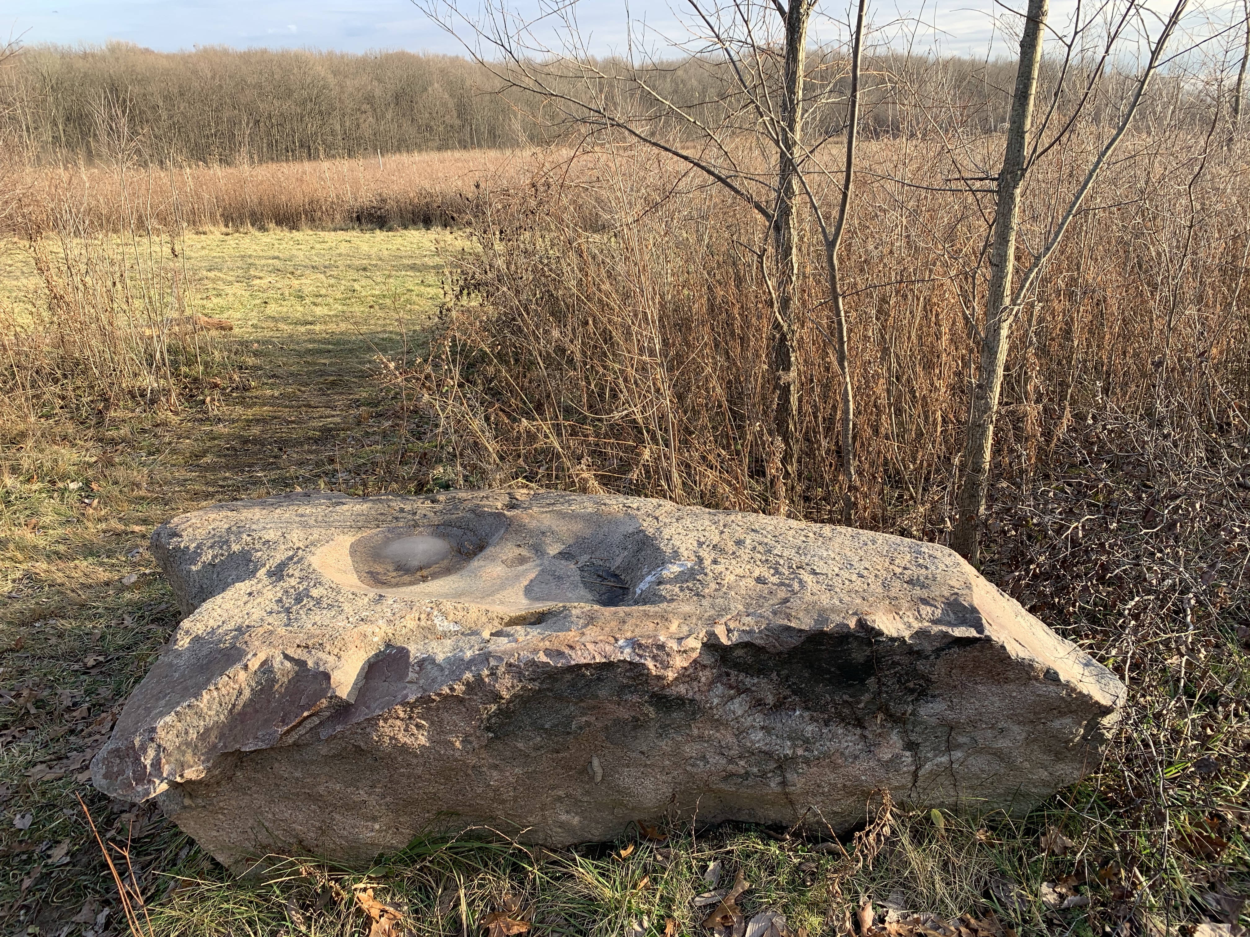
Why is it here?
How did it get here?
What or who made the depressions in the top?
What were they for?
So many questions, so few answers.
See their web site for schedule. Entrance is on Prospect Road,
and there are usually signs out showing you where to turn.
There is no access at any other time.
You can turn left (North) and head back to the main entrance on Prospect Road.
Or you continue on to head to the Conservancy Farm, Meyer Preserve and then into Jack R. Smiley Preserve.
and go along the edge of the field until you see the path through the fence row.
The field to the East can be accessed by crossing the drain.
There is a path on the other side which is maintained by local volunteers.
The brush was placed in piles to be burned during the winter.
I hope to add a new 360 photo when the grass is green during the summer of 2021.
Between the fields
Around the swamp
Over the bridge, along restoration area
And into the woods!
then turn left (North) on Berry Road.
In about .75 mile the entrance to Springhill
Preserve should be on your left (West side of the road.)
is located across the road at the Superior Township Hall.
and local police station.
Small, but nice, and popular.
Head through the woods.
Watch for fork in path, when you see it, head left. (East)
and soon you will arrive at the Jack R Smiley
trail head on Cherry Hill Road.
There are no real trails to, or in, this area.
However it can be accessed from the trail North of the farm gardens.
then turn right (West) when
you get to Cherry Hill.
you will enter the "Kosch-Headwaters Preserve" grounds.


may find the trail back to the
Springhill Preserve trailhead on Berry Road.
on Prospect Road, just south of Ford Road.


Future parking area.
Planning is in the works for parking, trails, etc.
There is limited parking by the road.
There are no maintained trails.
are to the North of Secrest Preserve.
Their entrance is on Warren Road.
The parking lot and trail head at Sibley West Prairie
They are not allowed on this property!
Not a far walk, but very nice.
It is a "Lollipop" so when you walk down the trail
eventually it loops back into the same trail to return.


I need to get some additional photos when the weather permits. Then I would like to add in some additional still photos of the points of interest at each location.